Sponsored by: MnDOT
Minnesota frequently experiences flooding mostly due to spring melts, but extent and timing of flooding is changing due to nonstationarity factors like climate change and land use changes. To counter the danger faced by drivers and the destruction that can be caused by flooding, Minnesota Department of Transportation (MnDOT) is seeking to mount remote water level gauges near waterways of interest. MnDOT is hoping for a cost efficient and long lasting solution that can be used to create a network throughout the state to proactively monitor flood conditions; alerting the public of potential flood impacts. This will allow Minnesotans to better prepare for flooding, and improve the resiliency of infrastructure.
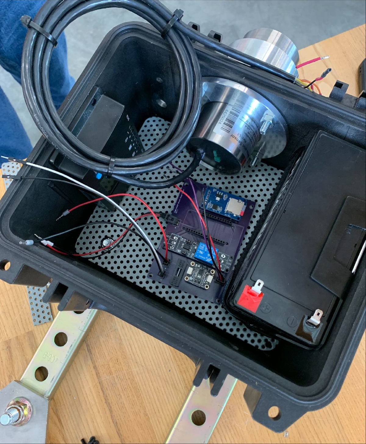
The goal of this project is to create a system that will monitor water surface elevations that can be easily mounted to nearby structures such as bridges and culverts. The system will provide live, remote updates of water surface elevation levels every 15 minutes and store the data long term externally and locally. This data will then be compared to a set elevation triggers, developed from site conditions and hydraulic modeling, to inform the MnDOT Hydraulics Unit of changing flood conditions.
Sponsored by: MnDOT
Student Team:
Industry Representative: Nick Olson
Faculty Advisor: Hassan Salamy
Pictured left to right: Olivia Ohnstad, Aidan Cross, Azhar Musse, and Malachi Brown